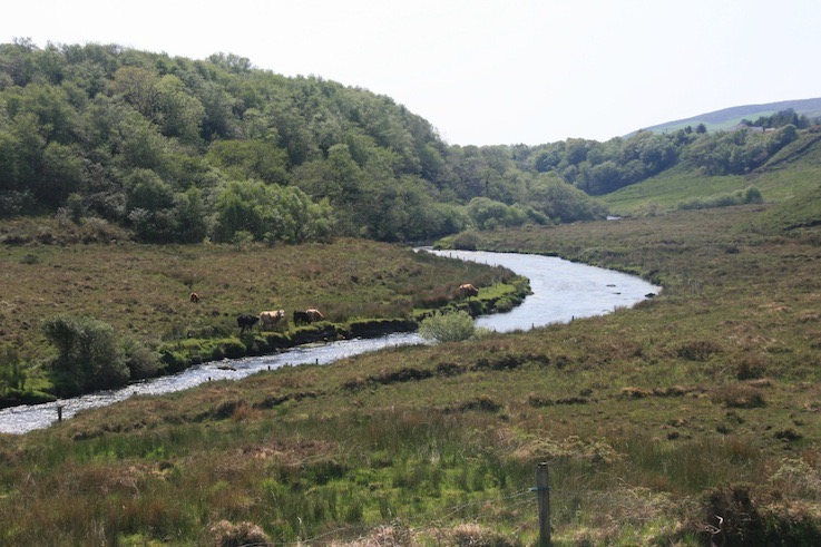
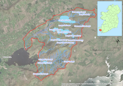
Located on the western side of the Iveragh Peninsula this catchment (74.8 sq km) drains to Lough Currane to the West. The catchment covers the lower slopes of the Macgillicuddy’s Reeks and has a number of lakes including Derriana Lake, Cloonaghlin Lough, and Isknagahiny Lough, from which the main tributaries flow westwards. The underlying geology is Old Red Sandstone and the dominant soil type is peat. Land use within the catchment includes forestry (5%), commonage, mixed livestock farming (ca 108 active farmers), and both active and historic peat cutting. Angling is popular along the main river channels within the catchment. The population of freshwater pearl mussels is estimated to be ca. 100,000 and occurs in the lower reaches of both the Cummeragh and the Capall River.
If you would like to see the catchment map in more detail, you can use our Eligible Areas Map.