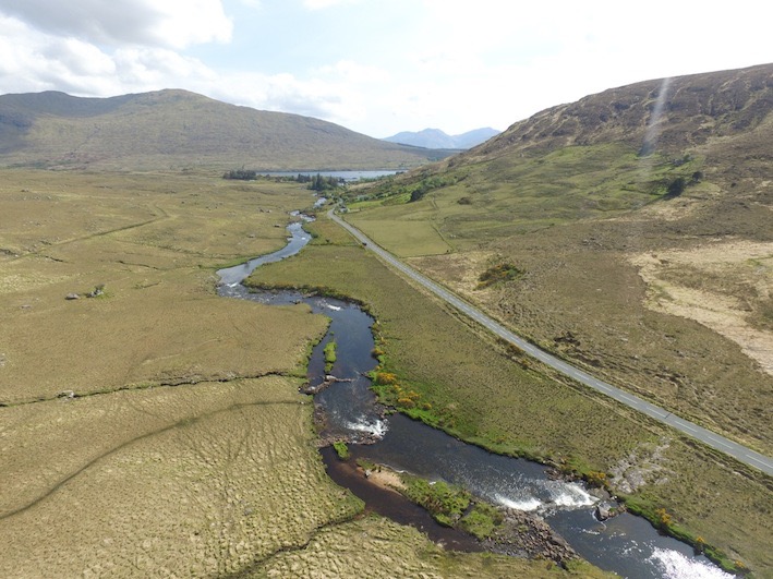
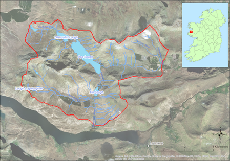
Located to the North-west of Leenaun this catchment (48.1 sq km) drains to the sea at Killary Harbour to the South. The catchment comprises a north-south orientated valley with the Mweelrea Mountains to the west and the Sheeffry Hills to the east. There are a number of lakes within the catchment including Doo Lough and Finn Lough, from which the Bundorragha River flows southwards. The underlying geology is predominantly acid comprising an Ordovician conglomerate. The dominant soil type is peat. Land use within the catchment includes forestry (6%), extensive areas of commonage, and sheep farming (ca 143 active farmers). There are two accommodation facilities (Delphi Lodge and Delphi Activity Centre) in proximity to the Bundorragha River and angling is popular. The population of freshwater pearl mussels is large and is concentrated in the lower reaches of the Bundorragha River.
If you would like to see the catchment map in more detail, you can use our Eligible Areas Map.