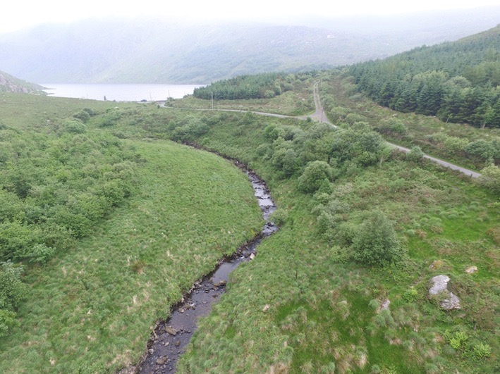
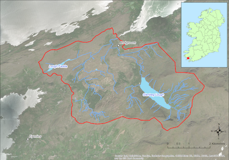
Located the northern side of the Beara Peninsula the catchment (22 sq km) drains to Kenmare Bay to the North. The catchment covers the lower slopes of the Caha Mountains and includes the scenic Glenbeg Lake from which the main Ownagappul River flows southwards. The underlying geology is Old Red Sandstone and the dominant soil type is peat. Land use within the catchment includes forestry (6%), commonage, mixed livestock farming (ca 96 active farmers), and historic peat cutting. Glenbeg Lake is used as a public drinking water source for much of the Beara Peninsula. The population of freshwater pearl mussels is estimated to be ca. 200,000 and is mostly concentrated on the main channel of the Ownagappul River.
If you would like to see the catchment map in more detail, you can use our Eligible Areas Map.